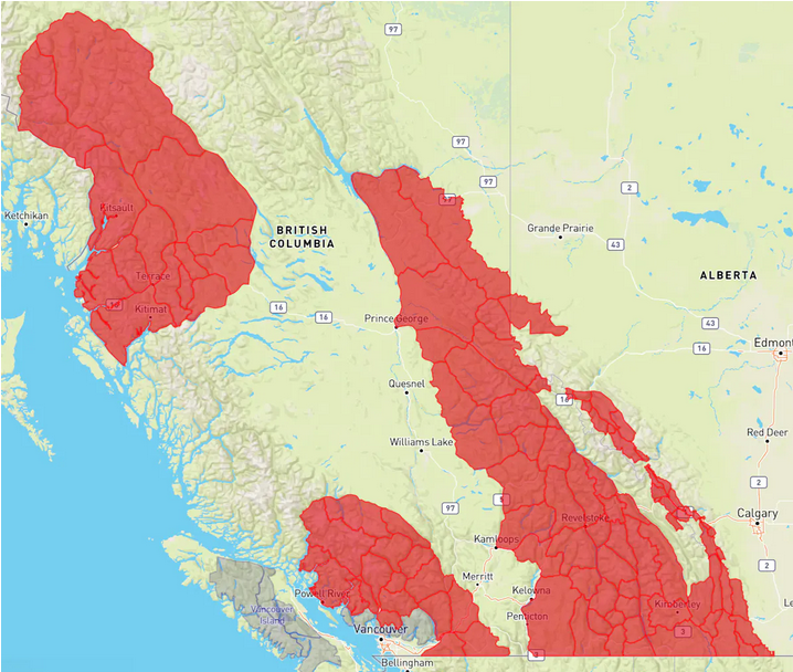
Avalanche Canada – Special public avalanche warning in effect for most of BC’s and Alberta’s forecast regions for February 29 through the end of Monday, March 4.
Be careful in the backcounrty.
Recent storms have deposited a significant amount of snow across Western Canada. This new snow sits on prominent weak layers established during drought conditions in February. In some areas, there is more than one weak layer.
As the active storm period passes, widespread natural avalanche activity will slow. However, human-triggered avalanches remain likely.
The structure of the weak layers takes different forms across our forecast regions, but is highly problematic and reactive in all. Remote triggering of avalanches on this layer will be possible. Recreationists should not underestimate the instability of these weak layers or their potential to produce large avalanches.
Although the new snow is appealing, making conservative terrain choices will be an important strategy for all backcountry users over the next few days. A good way to do this is by sticking to lower angle slopes, avoiding overhead hazard, and choosing smaller objectives that minimize the consequences of an avalanche.
Backcountry users should always check the avalanche forecast. Everyone in a backcountry party needs the essential rescue gear—transceiver, probe, and shovel—and the training to use it.