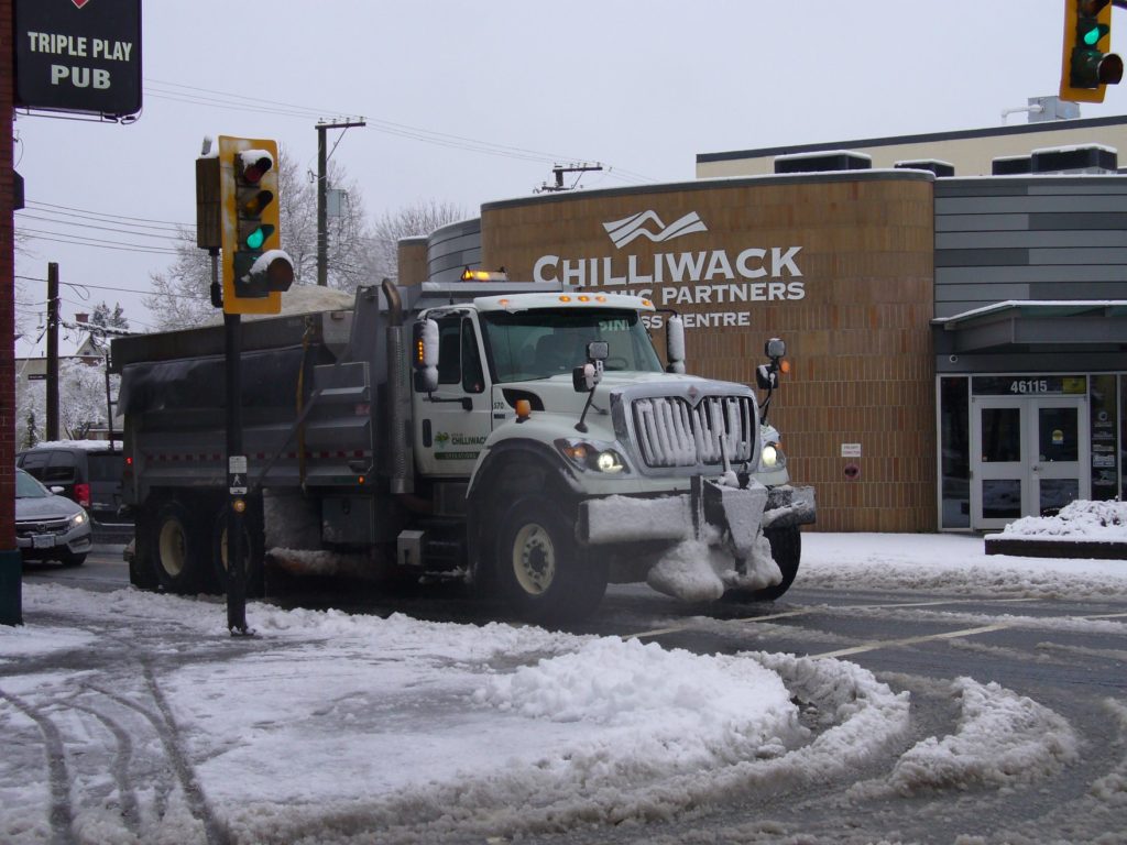
Fraser Valley – The arctic blast has set in place for the Valley and Lower Mainland for the remainder of the week.
It could be worse. Edmonton is expecting temperatures colder that Siberia. Anyone from that part of the world would simply call that — January.
Roger Pannett told FVN as of 6PM Sunday : From 07.30 to 14.30 ,6.0 cm wet snow & 1.0 mm light rain.
14.30 to 17.45 increasing snowfall . Another 15.2cm & Increasing blizzard conditions for the past couple of hours with now white out conditions !
To 15.45 ,> 20 cm on the ground.
Temperatures at -5 oC plus wind chill & continuing to fall!
Increasing north east Arctic outflow winds!
Stay safe!
And the Cultus Lake Community Association have a sense of humour:

As of 5PM SUNDAY:
4:21 PM PST Sunday 12 January 2020
Arctic outflow warning in effect for:
- Fraser Valley – central including Chilliwack
- Fraser Valley – east including Hope
- Fraser Valley – west including Abbotsford
Strong outflow winds and cold wind chill values are expected or occurring.
An arctic front will push through coastal inlets and valleys tonight.
Wind
speeds will rise to 30 to 50 km/h with gusts in the Fraser Valley up to
80 km/h. The wind combined with falling temperatures tonight and for
the next several days will generate wind chill values of -20 or lower.
Temperatures will not moderate until the end of the week.
If outside, dress warmly in layers and stay dry. Cover as much
exposed skin as possible to avoid frostbite. Ensure that shelter is
provided for pets and outdoor animals. Be prepared for unusually cold
temperatures and strong winds.
Please continue to monitor alerts
and forecasts issued by Environment Canada. To report severe weather,
send an email to BCstorm@canada.ca or tweet reports using #BCStorm.
4:13 PM PST Sunday 12 January 2020
Snowfall warning in effect for:
- Fraser Valley – east including Hope
A low pressure system over southern BC will continue to spread snow
over the region this evening. As well, an arctic front has arrived with
strong gusty winds resulting in dropping temperatures and blowing snow.
Additional amounts of 5 cm can be generally expected this evening before the snow eases as the system moves to the east.
Be prepared to adjust your driving with changing road conditions.
Prepare for quickly changing and deteriorating travel conditions.
Visibility may be suddenly reduced at times in heavy snow.
Please
continue to monitor alerts and forecasts issued by Environment Canada.
To report severe weather, send an email to BCstorm@canada.ca or tweet
reports using #BCStorm.
4:13 PM PST Sunday 12 January 2020
Snowfall warning in effect for:
- Coquihalla Highway – Hope to Merritt
A low pressure system over southern BC will continue to spread snow
over the region this evening. As well, an arctic front has arrived with
strong gusty winds resulting in dropping temperatures and blowing snow.
Additional amounts of 5 cm can be generally expected this evening before the snow eases as the system moves to the east.


