Victoria/Fraser Valley – Voters have a new way to learn about their new electoral district for British Columbia’s next provincial election, scheduled for October 19, 2024.
By entering their address at elections.bc.ca/mydistrict, voters can find the name and boundaries of their new district. The new districts will come into effect once the next election is called in the fall.
Elections BC is also mailing a brochure to every residential address in B.C. with a map of the new electoral districts in their region. Voters can expect to receive theirs before the end of March.
“Our focus at Elections BC is to prepare voters for what to expect when they vote later this year,” said Anton Boegman, Chief Electoral Officer of British Columbia. “There will not only be new electoral districts for B.C.’s next provincial election, but there will also be new technology at voting places to make voting faster and easier.”
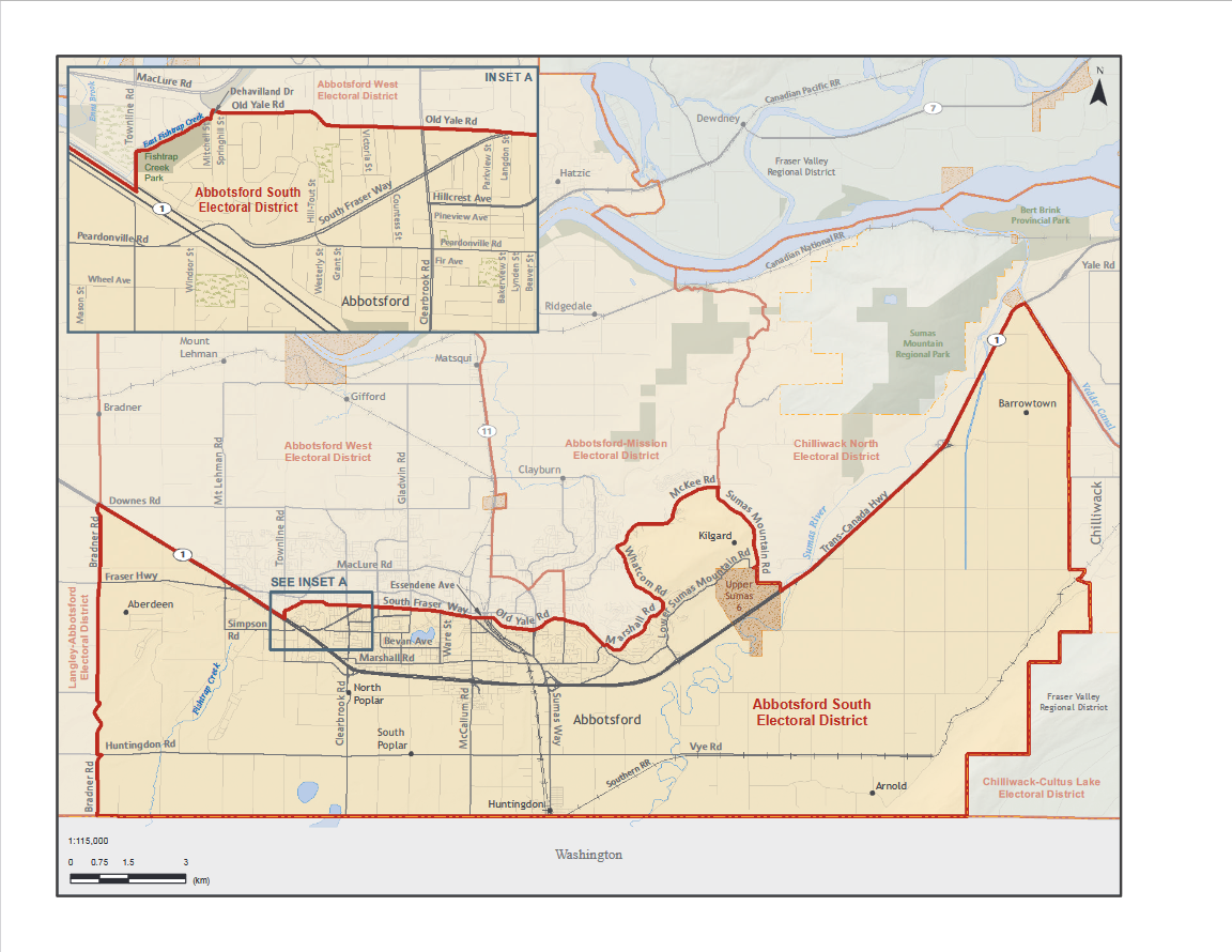
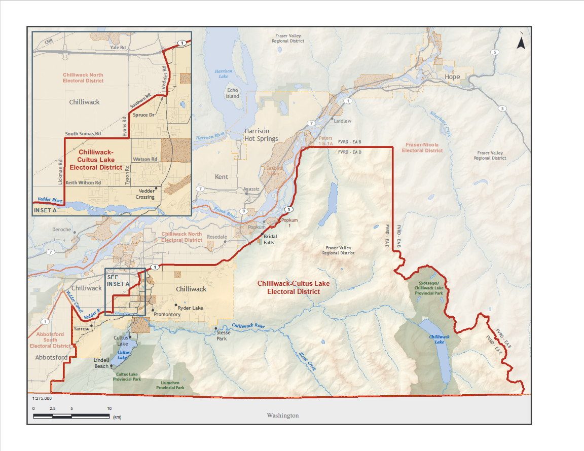
Electoral districts, also known as ridings or constituencies, are the geographic areas represented by Members of the Legislative Assembly. After every second provincial election, an independent, non-partisan commission is appointed to review B.C.’s provincial electoral districts and make recommendations for change. Recommendations are based on population growth and the need for effective representation throughout the province.
| LLA | Langley-Abbotsford | ED Map | EDVA Map |
| LWG | Langley-Walnut Grove | ED Map | EDVA Map |
| LWI | Langley-Willowbrook | ED Map | EDVA Map |
| MAE | Maple Ridge East | ED Map | EDVA Map |
| MAP | Maple Ridge-Pitt Meadows | ED Map | EDVA Map |
| SRC | Surrey City Centre | ED Map | EDVA Map |
| SRD | Surrey-Cloverdale | ED Map | EDVA Map |
| SRF | Surrey-Fleetwood | ED Map | EDVA Map |
| SRG | Surrey-Guildford | ED Map | EDVA Map |
| SRN | Surrey-Newton | ED Map | EDVA Map |
| SUN | Surrey North | ED Map | EDVA Map |
| SUP | Surrey-Panorama | ED Map | EDVA Map |
| SUR | Surrey-Serpentine River | ED Map | EDVA Map |
| SUS | Surrey South | ED Map | EDVA Map |
| SWR | Surrey-White Rock | ED Map | EDVA Map |