Fraser Valley – “Hold Me Beer” – Mother Nature
The January 2022 ice storm, almost one year ago, had us chipping out from under a layer Of Freezing Rain.
Environment Canada said that was the Worst Ice Storm since December 1995.
It appears we are going to top that.
A Pacific frontal system combined with the cold Arctic airmass over B.C. will bring another round of snow to the South Coast starting Thursday evening.
As freezing levels rise, heavy snow will become mixed with ice pellets and then change to rain late Friday over Vancouver Island, Friday night to Saturday over the mainland. The exact precipitation amounts and timing of the transition to rain still remain uncertain at this point. Current guidance indicates total snowfall accumulations ranging from 10 to 20 cm are expected. Local blowing snow is possible in strong easterly winds resulting in near zero visibilities.
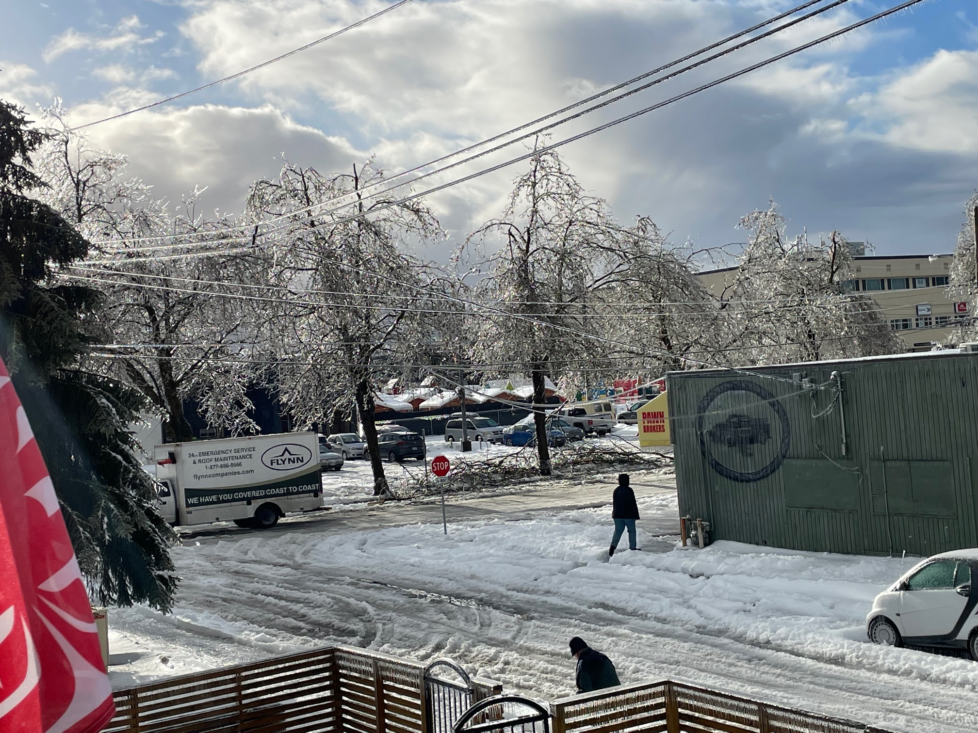
Furthermore, freezing rain is expected during the transition from snow to rain, which could cause significant impact on road conditions. For central and eastern Fraser Valley and inland Vancouver Island, periods of freezing rain could continue into Saturday afternoon.
Avoid travel if possible. Rapidly accumulating snow could make travel difficult over some locations. Visibility may be suddenly reduced at times in heavy snow. Surfaces such as highways, roads, walkways and parking lots may become icy and slippery. There may be a significant impact on rush hour traffic in urban areas.
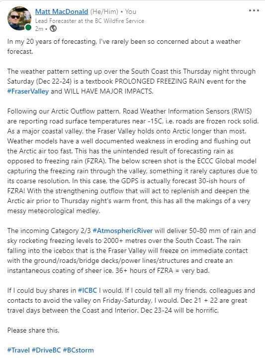
On Wednesday, Matt MacDonald, the lead forecaster at BC Wildfire Service took to social media with an ominous warning: “In my 20 years of forecasting, I’ve rarely been so concerned about a weather forecast.”