Fraser Valley – Environment Canada has issued a special weather statement for Metro Vancouver, the Fraser Valley, Howe Sound, Whistler and the Sea to Sky Highway, with a wintry mix of precipitation expected from Tuesday afternoon through Wednesday.
This mix of rain and snow could affect the Tuesday afternoon commute in the Lower Mainland. Drivers should ensure vehicles are properly equipped for winter conditions, including having winter or snow-rated tires in good condition.
The Province’s maintenance contractors will be out in full force applying brine and abrasives and clearing any accumulations of snow. In the Lower Mainland, the cable-collar systems on the Port Mann and Alex Fraser bridges will be in operation as necessary.
6PM MONDAY NIGHT UPDATE – Significant snowfall in addition to gusty winds are expected for the following routes beginning Tuesday night.
Coquihalla Highway – Hope to Merritt, Trans-Canada Highway – Eagle Pass to Rogers Pass, and Highway 3 – Paulson Summit to Kootenay Pass.
From Tuesday night into Thursday.
Snowfall accumulations of near 30 cm and southwest winds of 30 km/h gusting to 50 km/h.
A strong pacific frontal system will begin to push into the BC interior Tuesday evening. Snowfall will intensify overnight Tuesday and continue throughout Wednesday and into Thursday. In addition, gusty southwest winds will develop Wednesday and persist into Thursday. Snowfall amounts will vary along the routes due to elevation but totals near 30 cm can be expected.
The heavy snowfall and gusty winds should begin to taper off later Thursday. However, accumulating snow may continue along Highway 3 into Thursday evening.
Rapidly accumulating snow could make travel difficult over some locations. Visibility may be suddenly reduced at times in heavy snow.
For up-to-date information about road conditions, travellers should continue to monitor the forecast and visit: https://www.drivebc.ca/
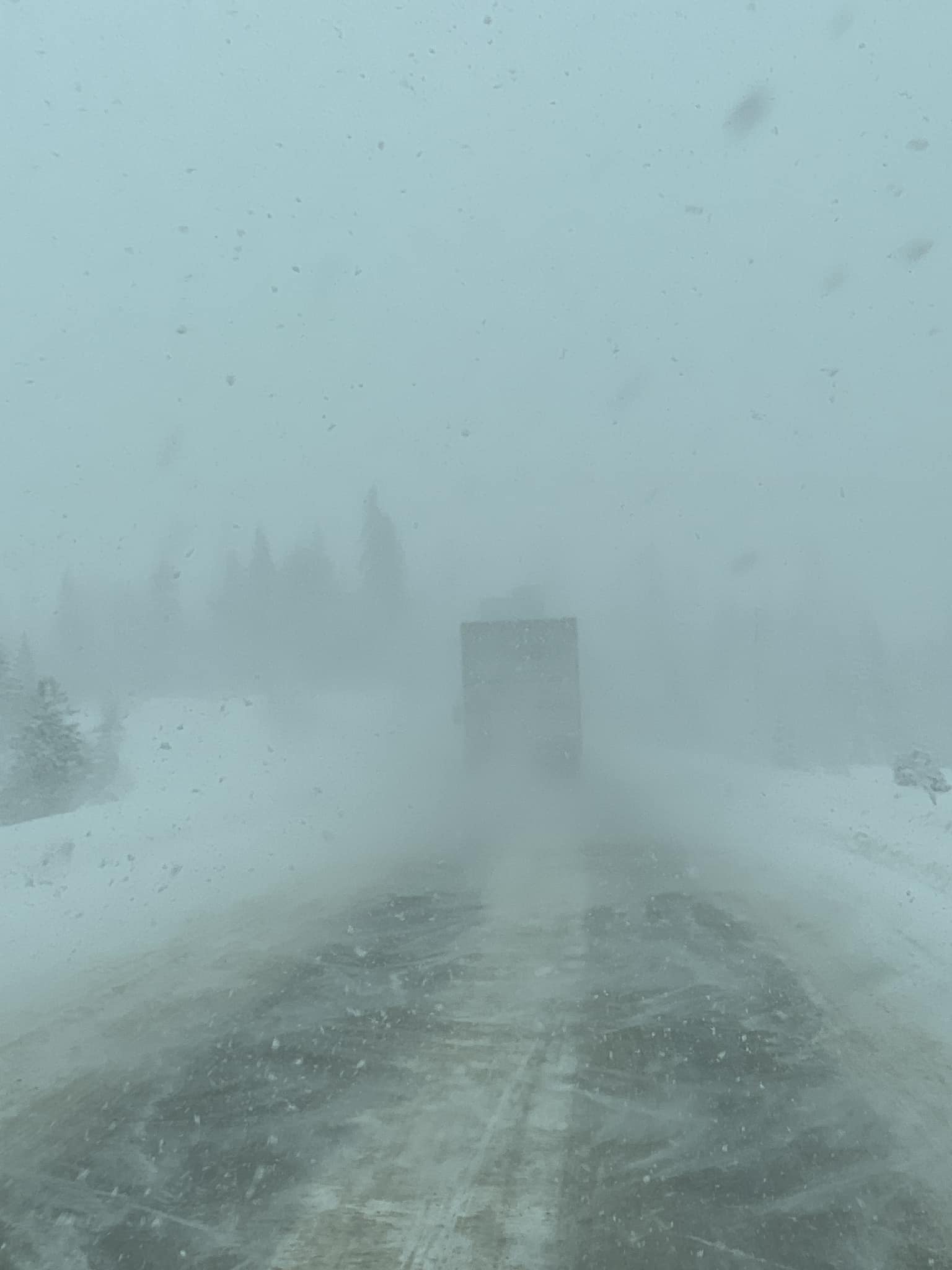
Pictures from the Coquihalla tell the tale.
Margie Jeff VanHeu