Chilliwack (Roger Pannett Environment Canada) – There was a reson that it was hard to sleep in the heet on Wednesday august 16.
According to Roger Pannett of Environment Canada:
Wednesday was the hottest day of heat wave at 35.8 C (+12.1 C)
That equaled the 35.8 C record in 2020.
August 16/23 also had a record High minimum at 18.5 C ( +7.3 C ) .Previous high min 17.7 C in 2014.
The High mean record at 27.15 C ( +9.65 C ) . Previous high mean 25.9 C in 2020.
Here’s where it gets tricky:
7:19 AM PDT Thursday 17 August 2023
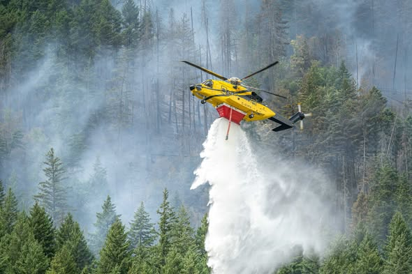
Widespread Gusty Winds and Risk of Thunderstorms into Friday. in the BC Interior.
Risk of dry lightning. Continued heat (southern interior).
Worsening wildfire conditions, possible new fire starts, risk of breaking tree branches, challenging boating conditions.
Widespread southwesterly winds of 30 km/h gusting 50 will develop this morning and switch to northwesterly 20 km/h gusting 50 near midday (Central Interior) or overnight and into Friday (southern interior) as a dry cold front passes. Instability along the cold front may lead to the development of thunderstorms this afternoon and evening, The main hazard is localized severe winds with speeds up to or above 70 km/h and dry lightning (lightning that comes with little or no rain).
Drought-stricken trees will be more susceptible to winds.