
Fraser Valley (with files from TWN The Weather Network) – The River Forecast Centre is issuing a High Streamflow Advisory for the Fraser Valley including the Chilliwack River and surrounding tributaries.
Also a State of Local Emergency continues in Fraser Valley Regional District for all 8 Electoral Areas. This State of Local Emergency is not applicable to municipalities or First Nations.
FVRD is continuing their State of Local Emergency for the purpose of sustaining evacuation orders which are posted on their website. This is maintain the ability to evacuate, should the need arise from the upcoming rain event.

A significant weather pattern change will occur this week. Temperatures are forecast to increase considerably compared to the recent extended cold weather and snowfalls. Additionally, moderate to heavy rainfall is expected for Tuesday and Wednesday (January 11‐12). The combination of low elevation snowpack, warming temperatures and heavy rainfall will result in rapid rises for creeks and rivers, especially at low and mid‐elevation watersheds on the coast. It could result in minor to significant flooding.
Rivers are expected to begin increasing on Tuesday and likely peak Wednesday or Thursday. The storms are still several days away, so the exact location and intensity of heaviest rainfall is still uncertain. Areas that experienced flooding last year may have added vulnerabilities due to erosion and higher baseflow conditions.
The upcoming temperatures are not forecast to be as warm as the atmospheric river events in November. It’s likely the upcoming storm systems will add to the very well‐developed snowpack at the higher elevations.
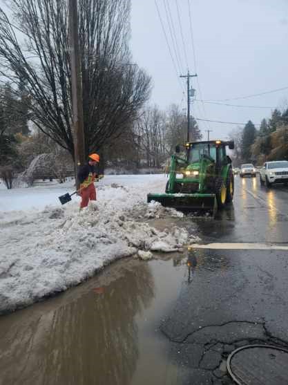
The public is advised to stay clear of the fast‐flowing rivers and potentially unstable riverbanks during the high‐streamflow period.
Special Weather Statement
A warmer and wetter weather pattern is on the way. Heavy rain is expected from Tuesday afternoon through Wednesday night.
A strong southwest flow will develop on Tuesday and result in an atmospheric river impacting the south coast. Heavy rain will develop later Tuesday as the first of several systems embedded in the flow arrives. Heavy rain will redevelop at times through Wednesday night as other systems arrive.
Snow levels will rise to between 1500 to 2000 metres. Some snowmelt at low levels will contribute to runoff which may result in high stream levels and localized flooding.
Please continue to monitor alerts and forecasts issued by Environment Canada. To report severe weather, send an email to BCstorm@ec.gc.ca or tweet reports using #BCStorm.