Fraser Valley – Ugggh. The “S” Word.
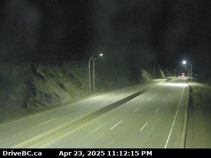
Early season wet snow over higher terrain is happening on Friday morning as a modified Arctic airmass arrives on the coast. Below seasonal temperatures will continue through the weekend.
A low pressure system will pass just off Vancouver Island Friday morning and move onto the Washington coast Friday evening. Meanwhile, Arctic air will advance southward through the B.C. interior. The onset of precipitation combined with falling temperatures will bring a risk of wet snow to neighbourhoods and roadways above 300 m.
The system will move out of the region Friday evening but a cold airmass settling in behind will ensure temperatures remain 5 to 8 degrees below seasonal normals.