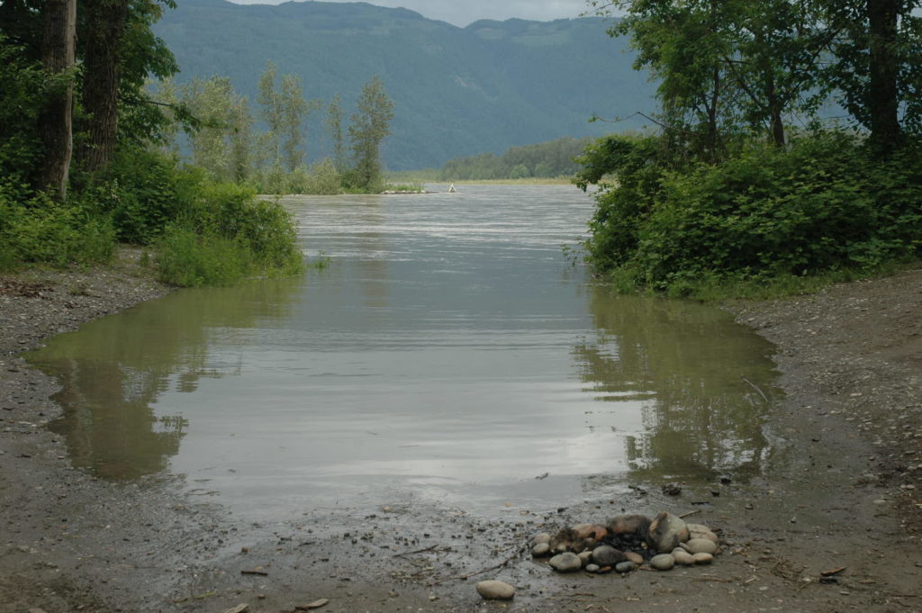
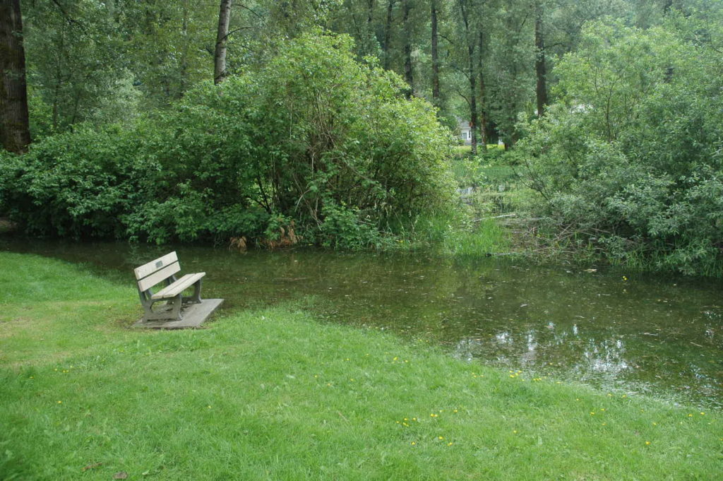
Victoria/Fraser Valley – While the River Forecast Centre is hopeful that the freshet won’t match 1997 or 2012 ( and heaven forbid, worse years) damage is still there. A few trees off Vedder Trail near the Vedder Campsite have washed into the Vedder River. A section of the trail is closed until the bank is stabilized with rocks and gravel.
FVN crews checked out the Gill Road Boat Launch and Hope Slough, and minor flooding is occouring.

JUNE 2 ORIGINAL STORY – Residents in many parts of the province have already experienced flooding. Emergency Management BC, the Ministry of Forests, Lands, Natural Resource Operations and Rural Development, and the Ministry of Transportation and Infrastructure are working together with regional districts, First Nations and local governments to keep people safe and minimize damage.
The FVRD retweeted the River Forecast Centre’s prediction the peak for the Fraser River for June 4-5.
It is hoped that the freshet will NOT be as extreme as 1997 or 2012.
http://bcrfc.env.gov.bc.ca/freshet/lower_fraser/LFR-10-DayFloodLevelForecasts.pdf
Emergency Management BC assists local governments in response to flooding. To date, provincial actions include:
- deploying 1.3 million sandbags to local governments to protect homes and public infrastructure (2.9 million sandbags remain in the provincial stockpile);
- deploying or pre-positioning 15 sandbag machines to areas of flood concern or potential flood concern throughout the province;
- shipping 5.7 km of gabions (wall-like structures filled with sand) and 12.6 km of tiger dams (stackable orange tubes filled with water) to the central, southeast, and southwest regions (14 km of gabions and 27 km of tiger dams remain in the provincial stockpile);
- more than 120 BC Wildfire Service employees supporting flood response across the province to assist with flood mitigation and sandbagging;
- deploying search-and-rescue groups in the central and southeast regions to assist in distributing evacuation alerts to properties in the Central Kootenay and Okanagan-Similkameen over the past weekend;
- the River Forecast Centre and regional operations are providing water flow expertise, as well as dam safety officers, geotechnical specialists and engineers in affected areas;
- launching a digital registration system, through Emergency Management BC, for emergency support services to provide timely access to support and enable safe physical distancing during the COVID-19 pandemic, which protects both volunteers and evacuees;
- working with local accommodation providers and support suppliers to ensure goods and services are available to evacuees while helping to protect the safety of all those involved;
- working with non-profit organizations, such as the Salvation Army and the Canadian Red Cross, to make sure the immediate needs of evacuees are supported; and
- working with the First Nations Health Authority and Indigenous Services Canada to make sure First Nations in British Columbia have the supports they need.
Emergency Management BC asks residents in affected regions to take precautions to ensure personal safety, including developing a household plan, putting together emergency kits, connecting with neighbours and learning about the local government emergency response plan for their area. As well, British Columbians can take the following steps:
- Protect your home: The public is advised to prepare for possible flooding of low-lying areas by moving equipment and other assets from these areas to higher ground, where possible. Clear perimeter drains, eavestroughs and gutters. Sandbags also help and can be made available through your local government.
- Create grab-and-go bags: Assemble an individual emergency grab-and-go bag for each member of your household with the essentials needed if you are asked to evacuate.
- Recognize the danger signs: If you live near a waterway, a change in water colour or rapid change in water level (especially a drop) could indicate a problem upstream. Call the local fire, police or public works department immediately if you suspect something out of the ordinary.
If you face a threatening flood situation, park vehicles away from streams and waterways, move electrical appliances to upper floors and anchor fuel supplies. Listen to local officials if you are asked to evacuate. In the event of flooding, here are some tips about what to avoid:
- Steer clear of river shorelines:
- Keep away from river edges and shorelines. During periods of high flow, river banks may be unstable and more prone to sudden collapse. Stay well away and keep young children and pets away from the banks of fast-flowing streams and flooded areas or bridges.
- Do not drive through flood water:
- Never attempt to drive or walk in flood water. Just 152 millimetres (six inches) of fast-moving water can knock over an adult. And 0.6 metres (two feet) of rushing water can carry away most vehicles, including SUVs and pickup trucks.
- Landslide risk:
- Heavy rain and snowmelt may contribute to landslides and dangerous debris in creeks and waterways. Be safe and do not go down to watch the rushing water. If you notice trees beginning to lean or bend near your home, or cracks developing in the hillside, consult an engineer or contact local authorities.