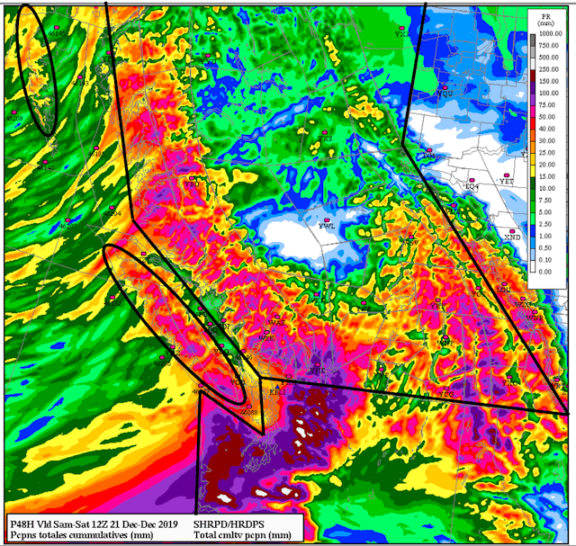
Revelstoke (Simon Horton, Avalanche Canada) – Southern BC and Alberta are now slammed by an intense “atmospheric river” bringing upwards of 60 cm of new snow on Friday and Saturday. Atmospheric rivers are concentrated bands of moisture that produce intense precipitation when they hit the rugged west coast of North America. This storm will have a significant impact on avalanche conditions in southern regions.
Highway 1, 3 and the Coquihalla into the Interior from the Lower Mainland have been inundated with rain and snow, depending on elevation.
It’s pretty clear that the atmospheric river will result in HIGH avalanche danger for many regions the next few days. What’s less clear is how quickly the snowpack will recover after the storm. In many regions it will likely take time for the snowpack to gain strength, which will call for a patient and cautious approach to backcountry travel after the storm.
Total accumulated precipitation between Thursday and Saturday morning (red and purple areas could see 50-100 mm);